
Station: CEL - Celeste (Italy)
|
GENERAL INFORMATION | |
| Station | CEL |
| Network (FDSN code) | MN |
| Municipality | Celeste |
| Latitude[N] | 38.2603 |
| Longitude[E] | 15.8939 |
| Elevation [m - a.s.l.] | 702 |
| Starting Date | 2012-11-15 |
| Ending Date | - |
| Recorder | Q330 |
| Accelerometric stream | HN |
| Accelerometric sensor | EPISENSOR-FBA |
| Full Scale [g] | 2 |
| Location | 00 |
| Sampling [Hz] | 100 |
| Channel-Sensitivity | 427692 |
| Velocimetric stream | HH |
| Velocimetric sensor | STS-2-120 |
| Channel-Sensitivity | 6.29145e+08 |
| Transmission System | INTERNET |
| XML station file | download |
For details see TECHNICAL NOTES
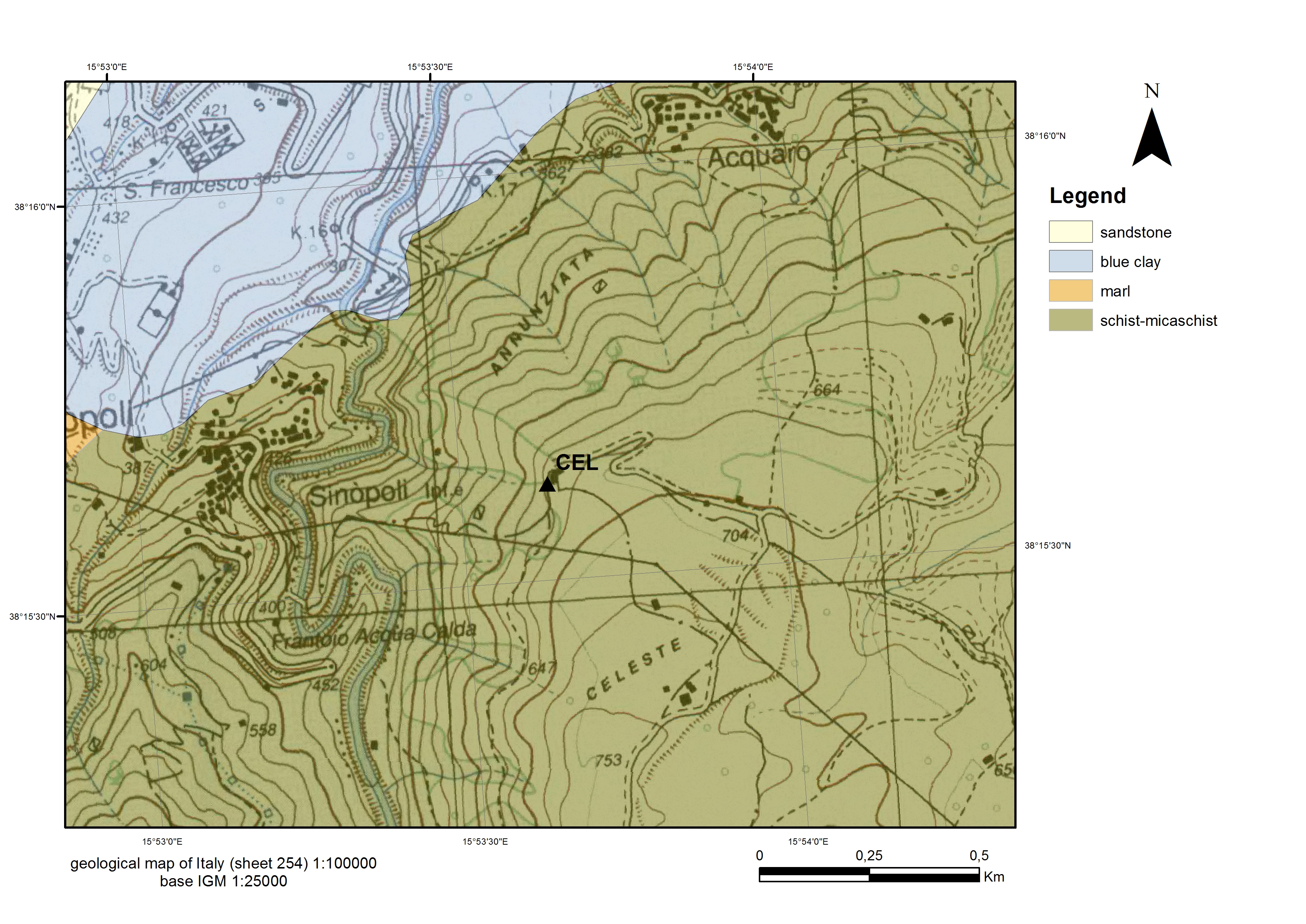
GEOLOGY | |
| ISMD class | Metamorphic-Rock |
| map 100k | schist-micaschist |
| map 50k | missing |
| map 10k | missing |
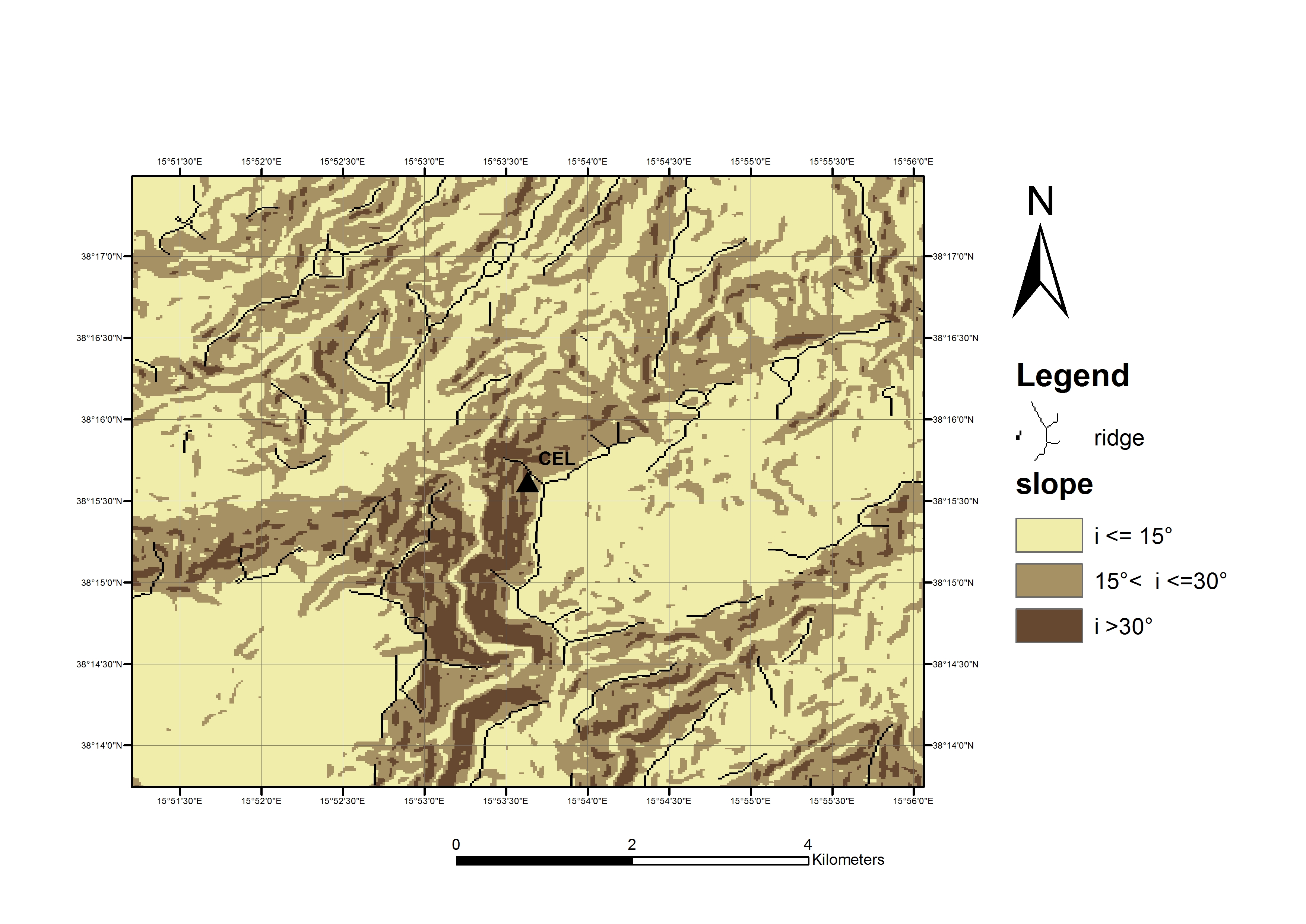
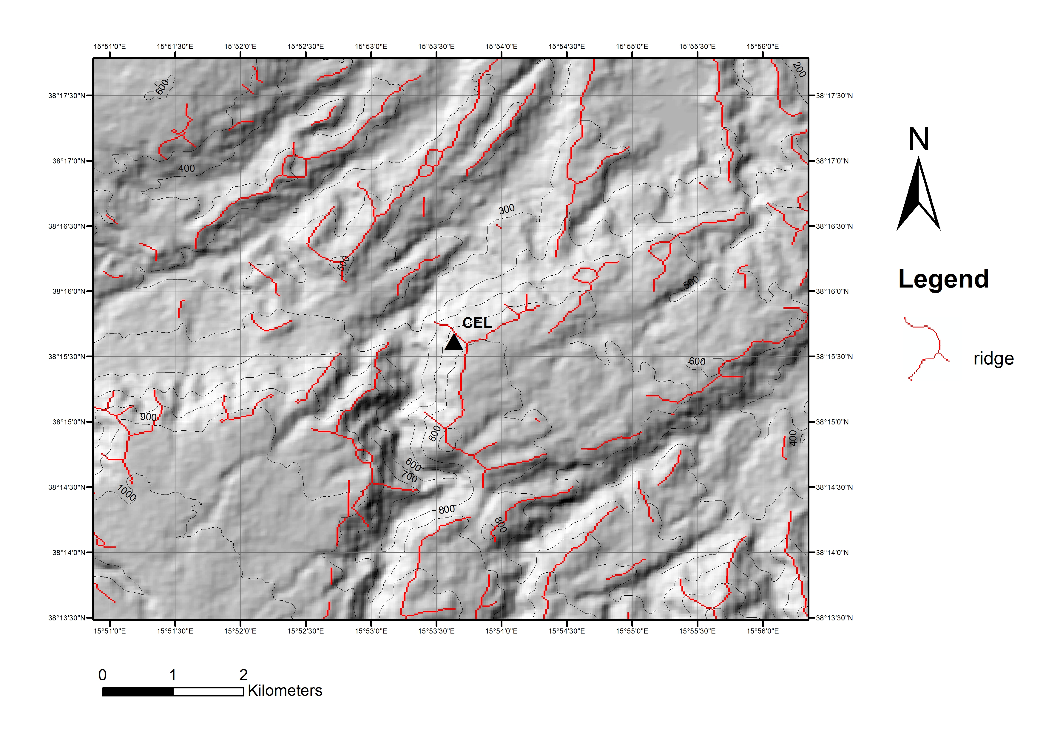
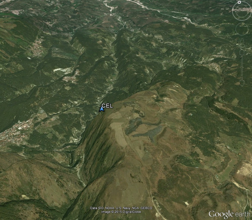
MORPHOLOGY | |
| ISMD class | relief |
| position | slope |
| DEM | map |
| Google Earth | 3D view |
GEOPHYSICS | |
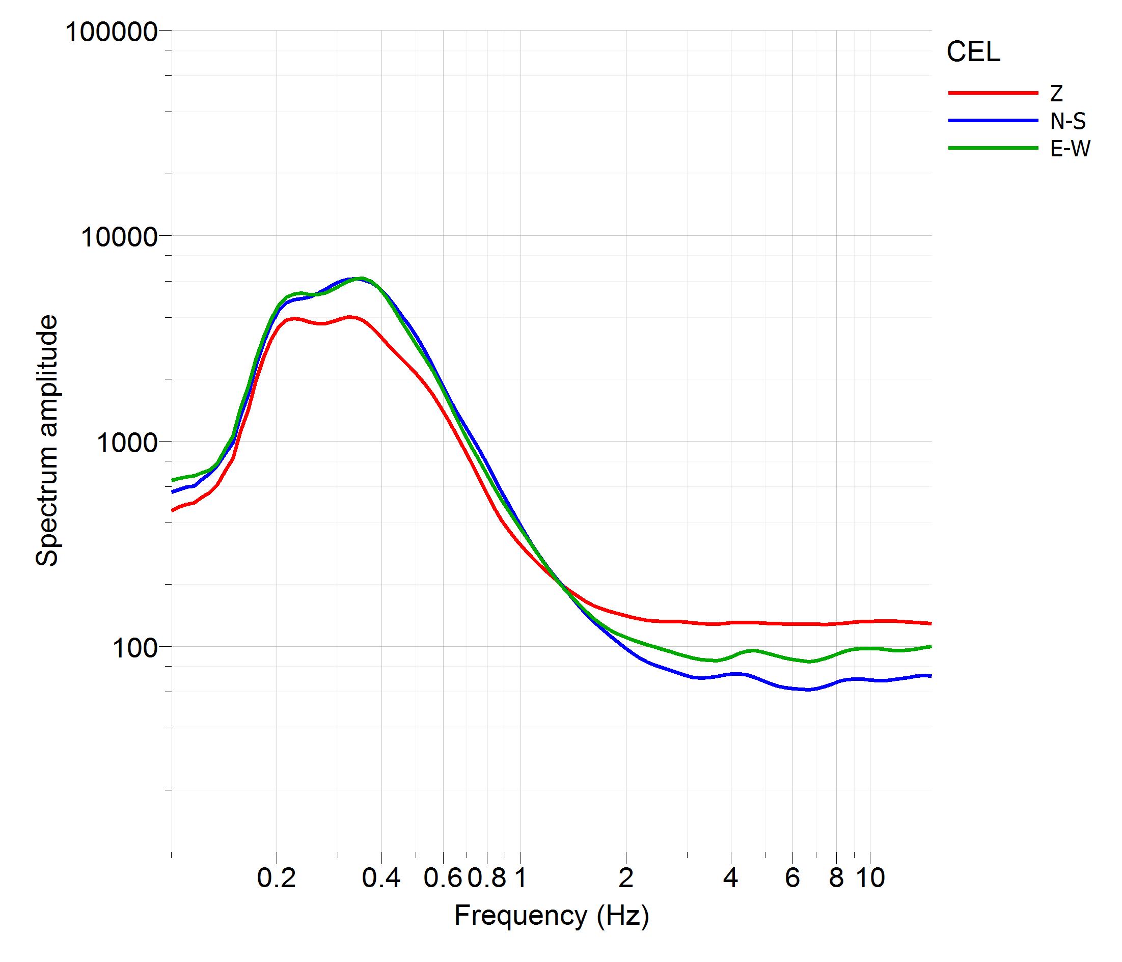
| noise Fourier spectra | Image |
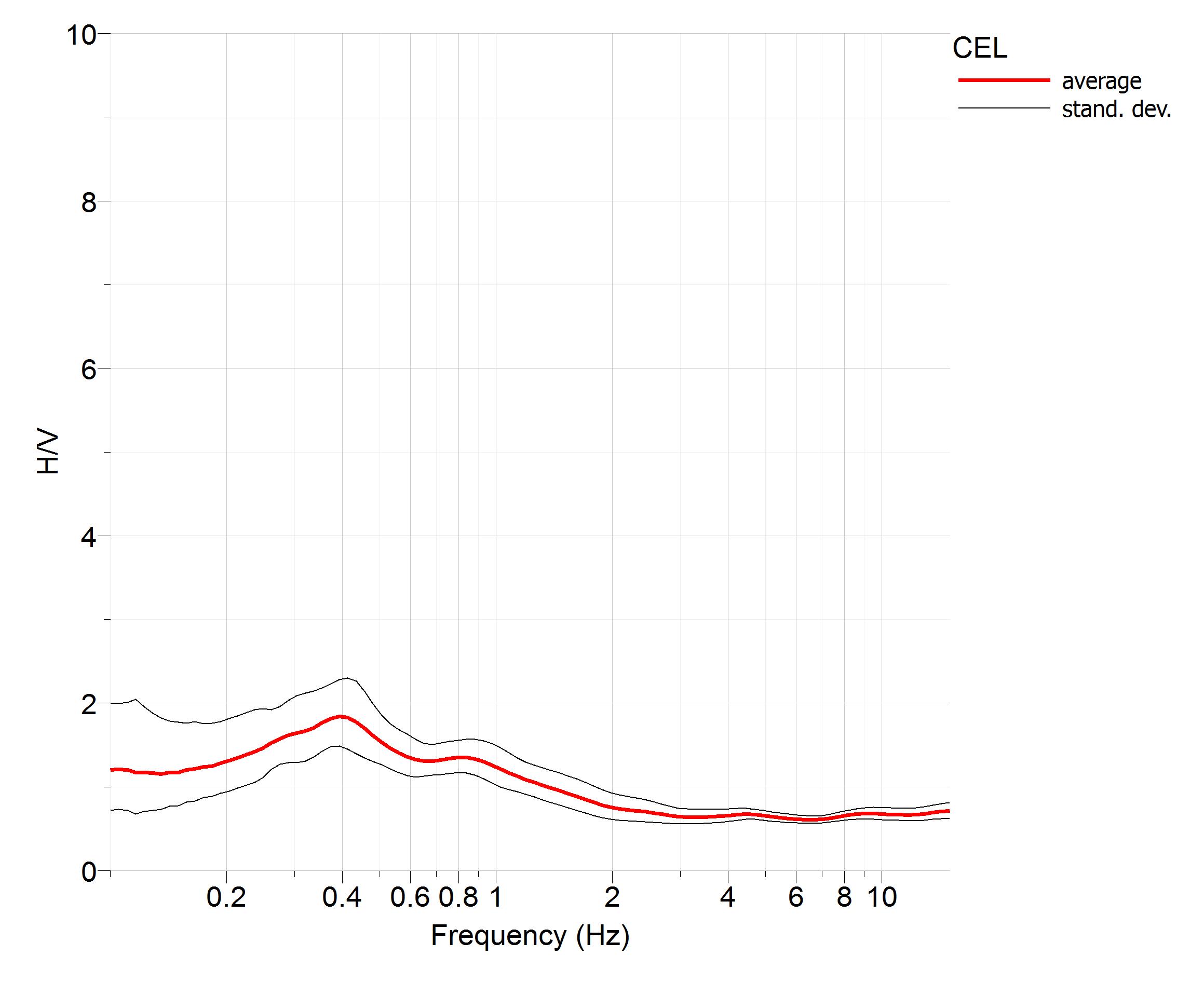
| noise HVSR | Image |
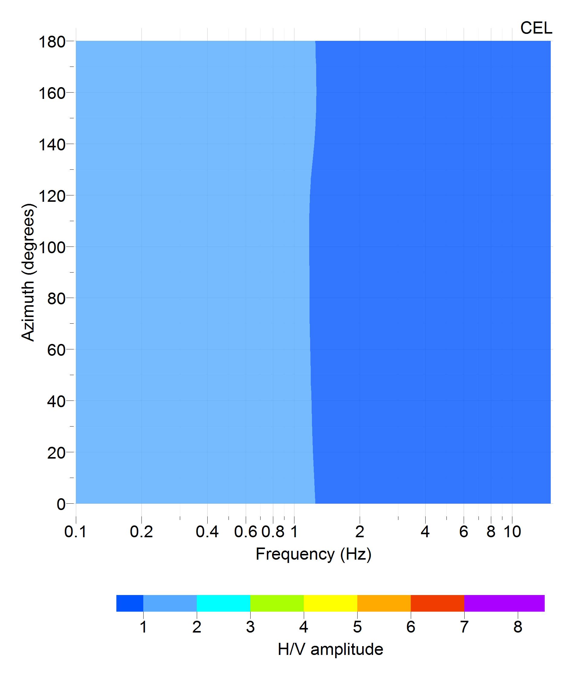
| directional HVSR | Image |
| f0 [Hz] notes | none none |
| dispersion curve | missing |
| Vs profile | missing |
| Vs30 [m/s] | missing |
| Vs,eq [m/s] | missing |
SEISMIC CODE | |
| soil category NTC08 | B* |
| soil category NTC18 | missing |
| topographic category | T2* |
© 2024 ISMD: INGV Strong Motion Data web portal |  CITATION | COOKIE & PRIVACY | DISCLAIMER | CREDITS | CONTACTS |