
Station: OPPE - Oppeano (Italy)
|
GENERAL INFORMATION | |
| Station | OPPE |
| Network (FDSN code) | IV |
| Municipality | Oppeano |
| Latitude[N] | 45.3082 |
| Longitude[E] | 11.1723 |
| Elevation [m - a.s.l.] | 20 |
| Starting Date | 2009-09-24 |
| Ending Date | - |
| Recorder | CENTAUR |
| Accelerometric stream | HN |
| Accelerometric sensor | TITAN |
| Full Scale [g] | 2 |
| Location | 00 |
| Sampling [Hz] | 200 |
| Channel-Sensitivity | 407880 |
| Velocimetric stream | HH |
| Velocimetric sensor | TRILLIUM-120C |
| Channel-Sensitivity | 2.9964e+08 |
| Transmission System | UMTS |
| XML station file | download |
For details see TECHNICAL NOTES
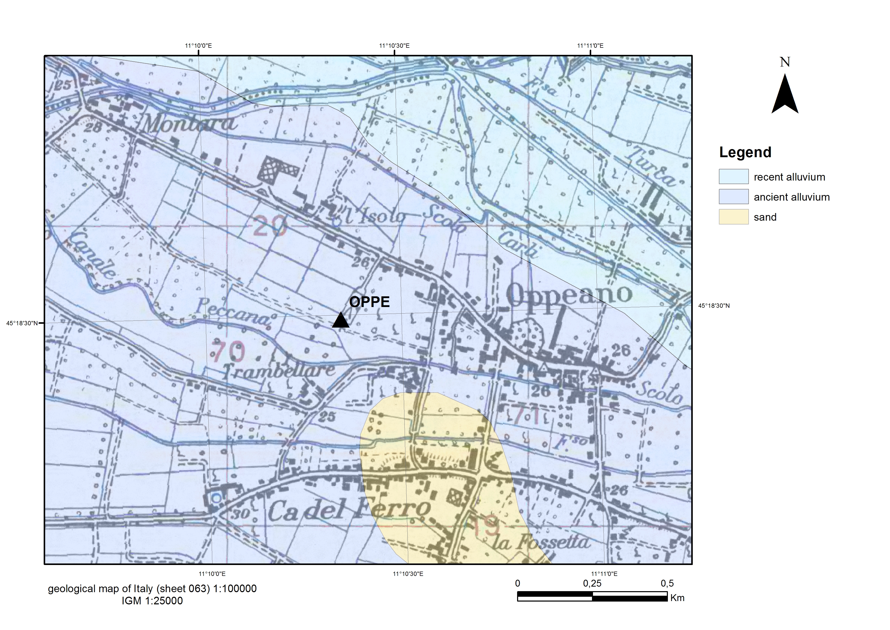
GEOLOGY | |
| ISMD class | Sedimentary-cover |
| map 100k | alluvial-deposits |
| map 50k | missing |
| map 10k | missing |
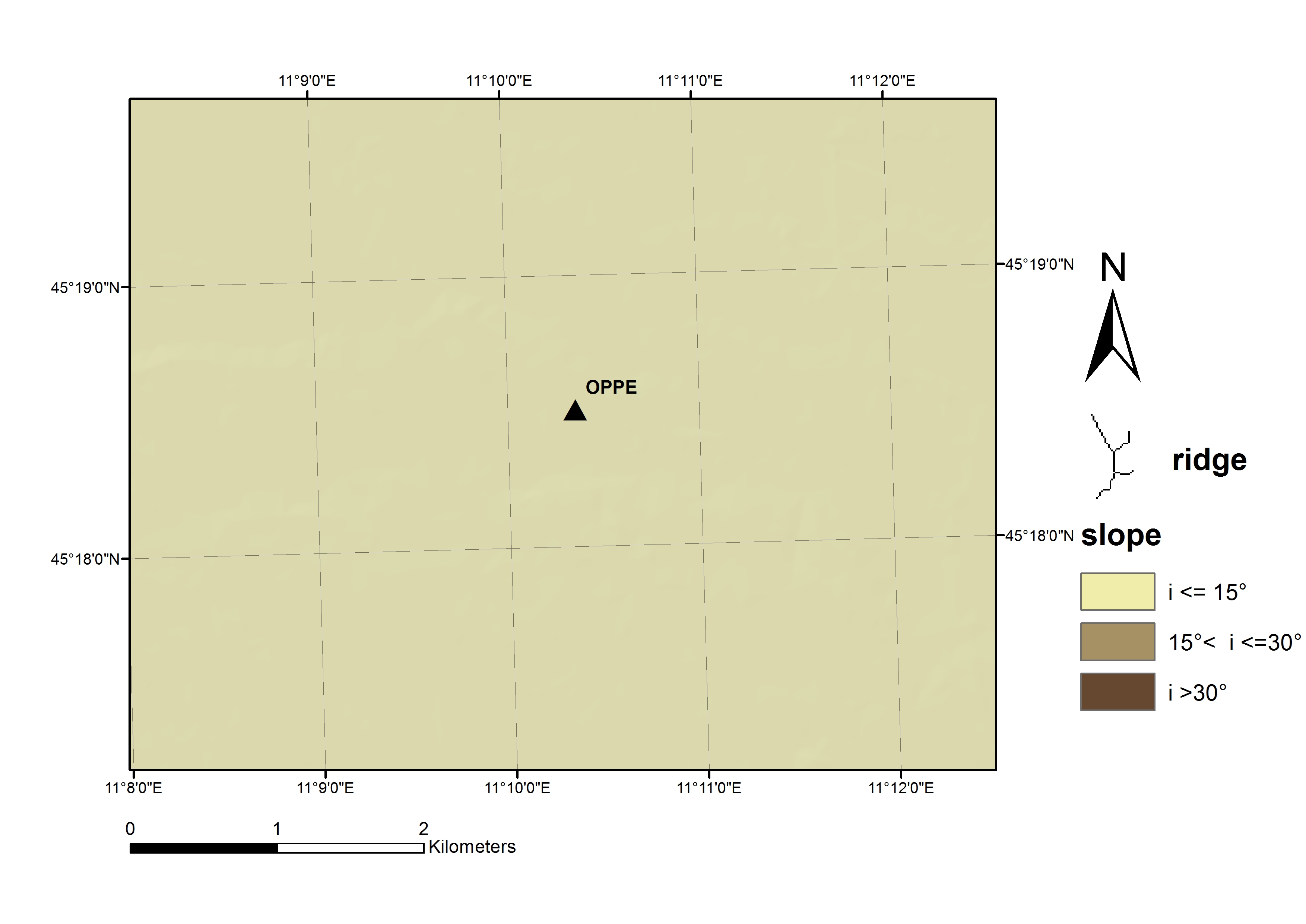
MORPHOLOGY | |
| ISMD class | plain |
| position | center |
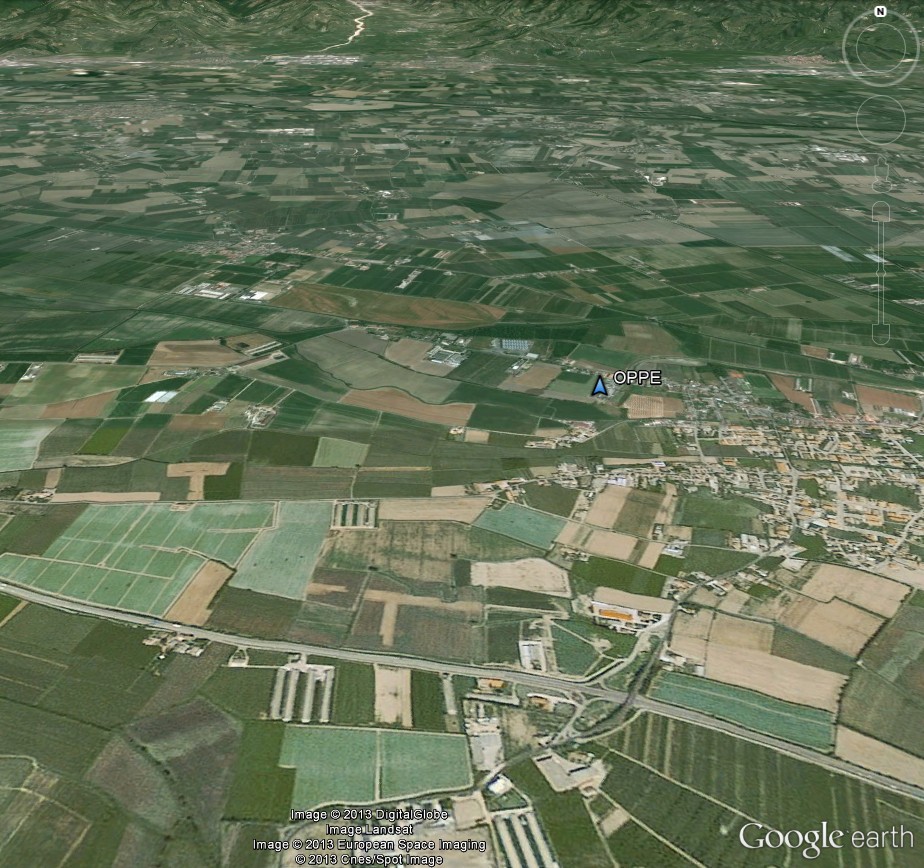
| DEM | map |
| Google Earth | 3D view |
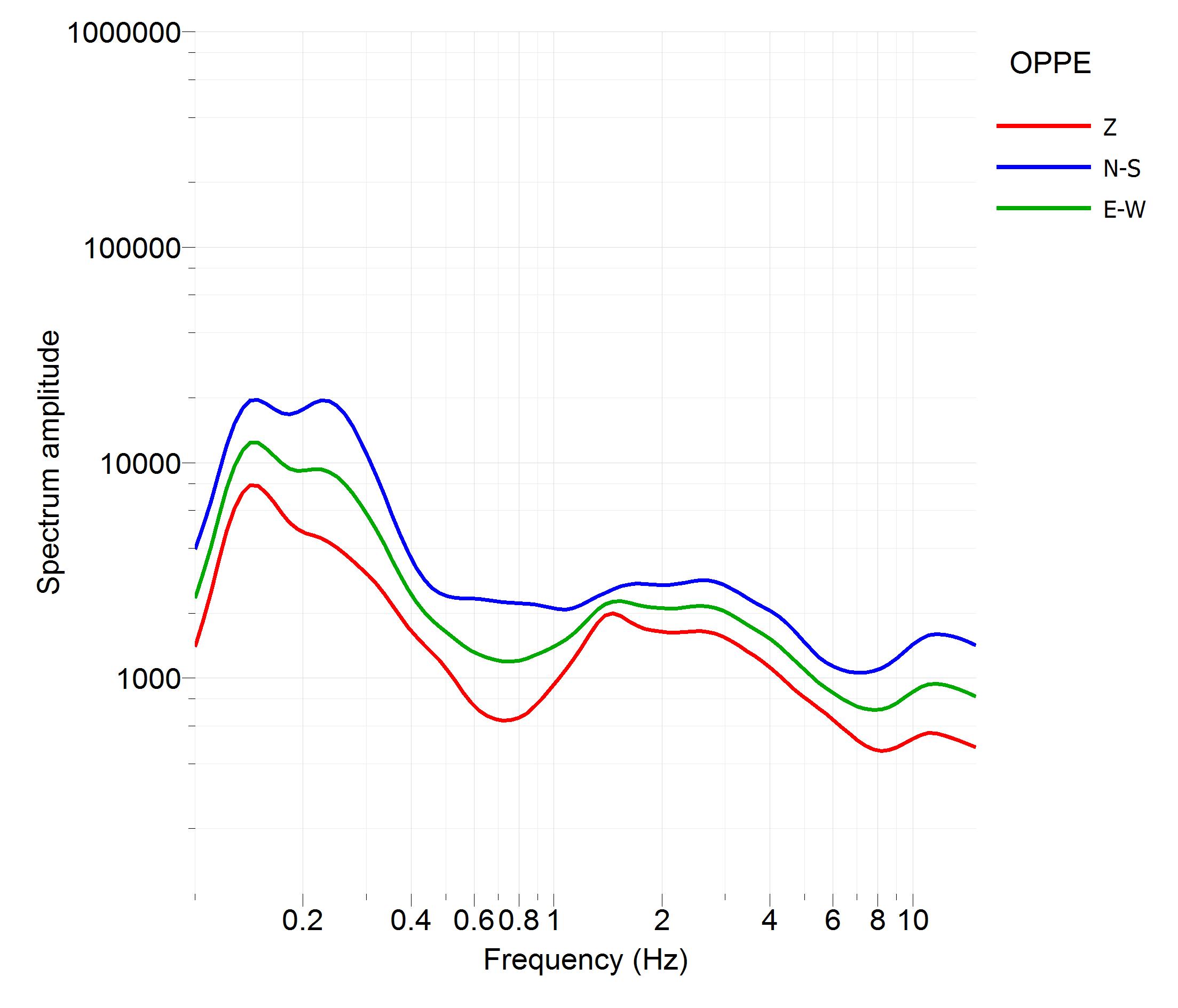
GEOPHYSICS | |
| noise Fourier spectra | Image |
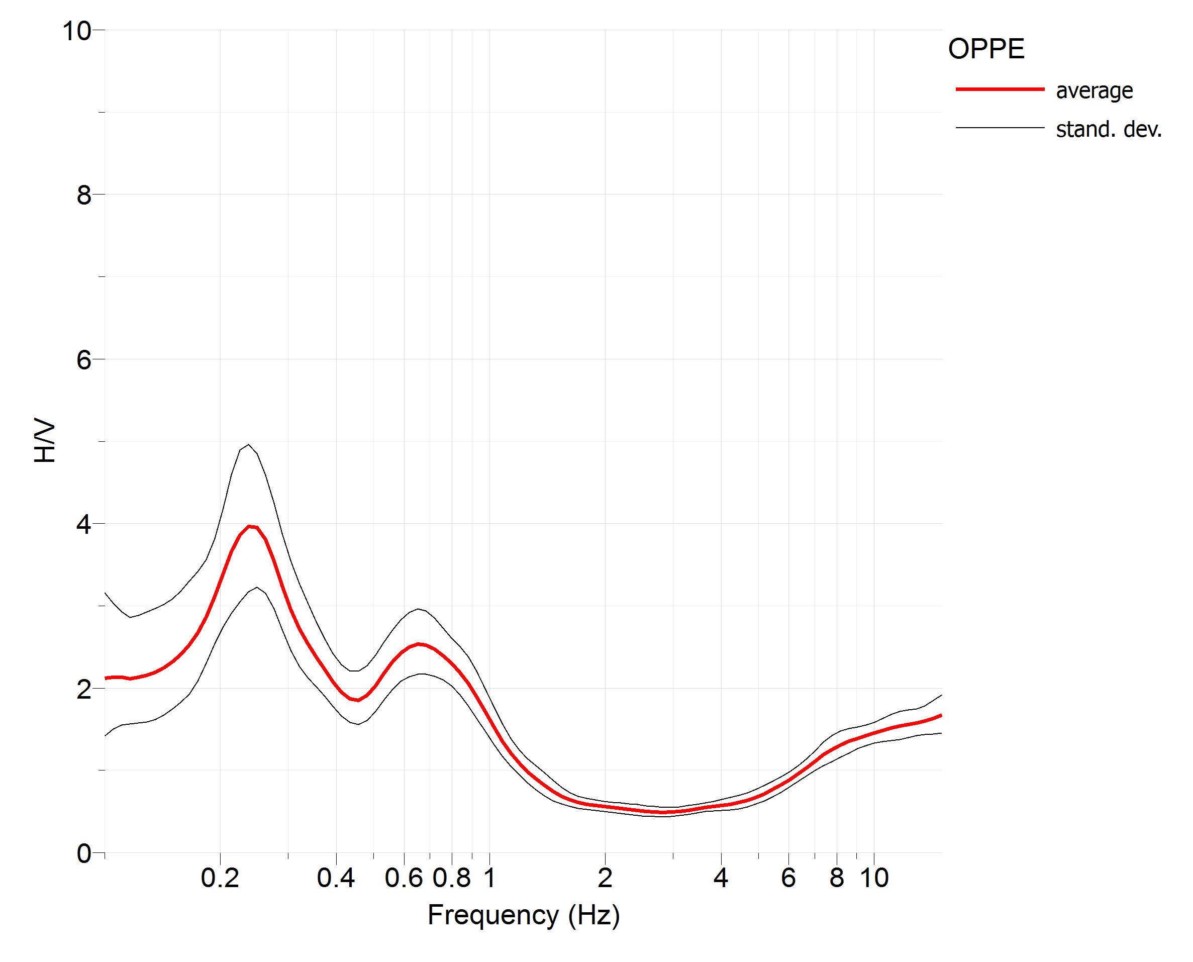
| noise HVSR | Image |
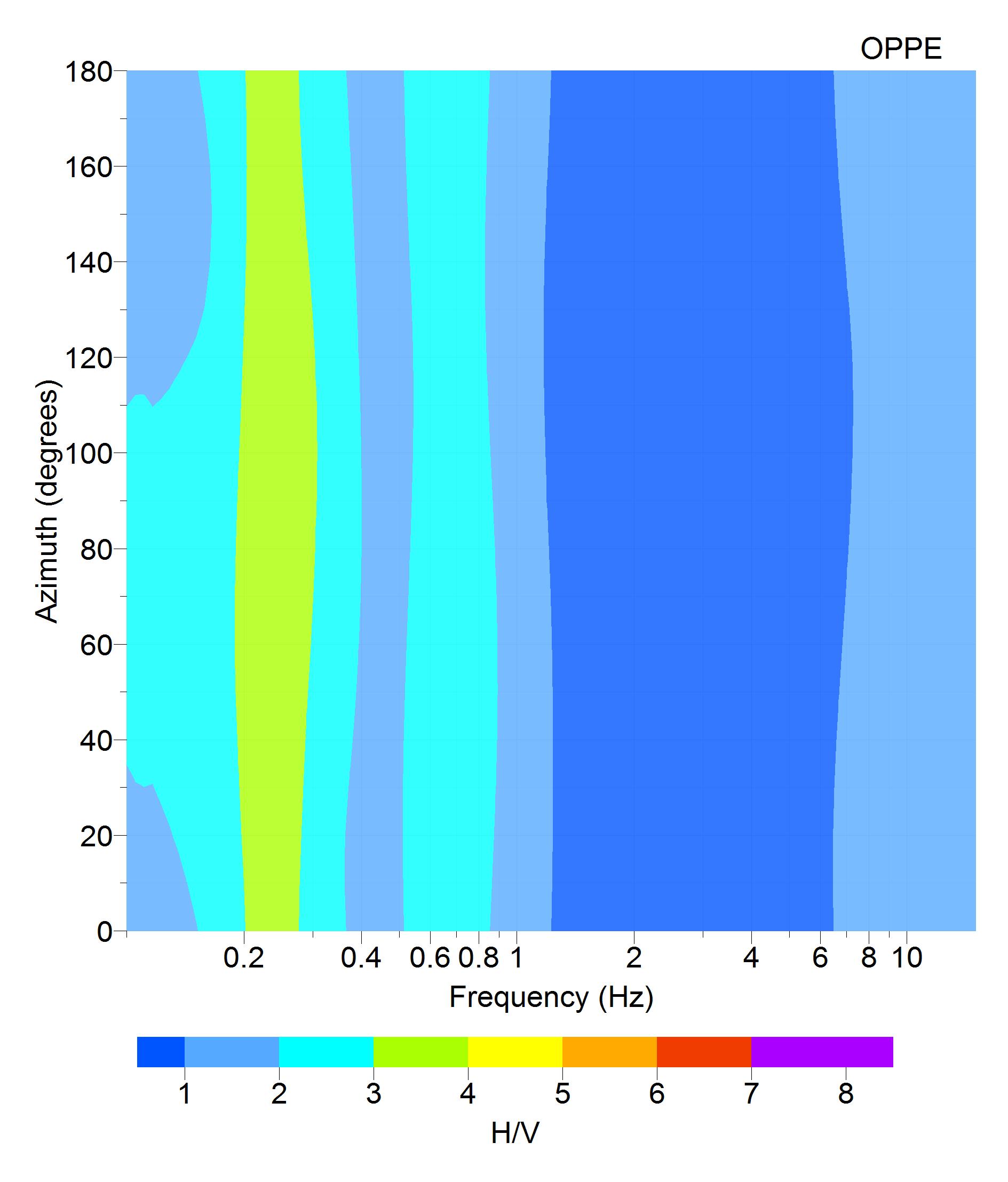
| directional HVSR | Image |
| f0 [Hz] notes | 0.25 none |
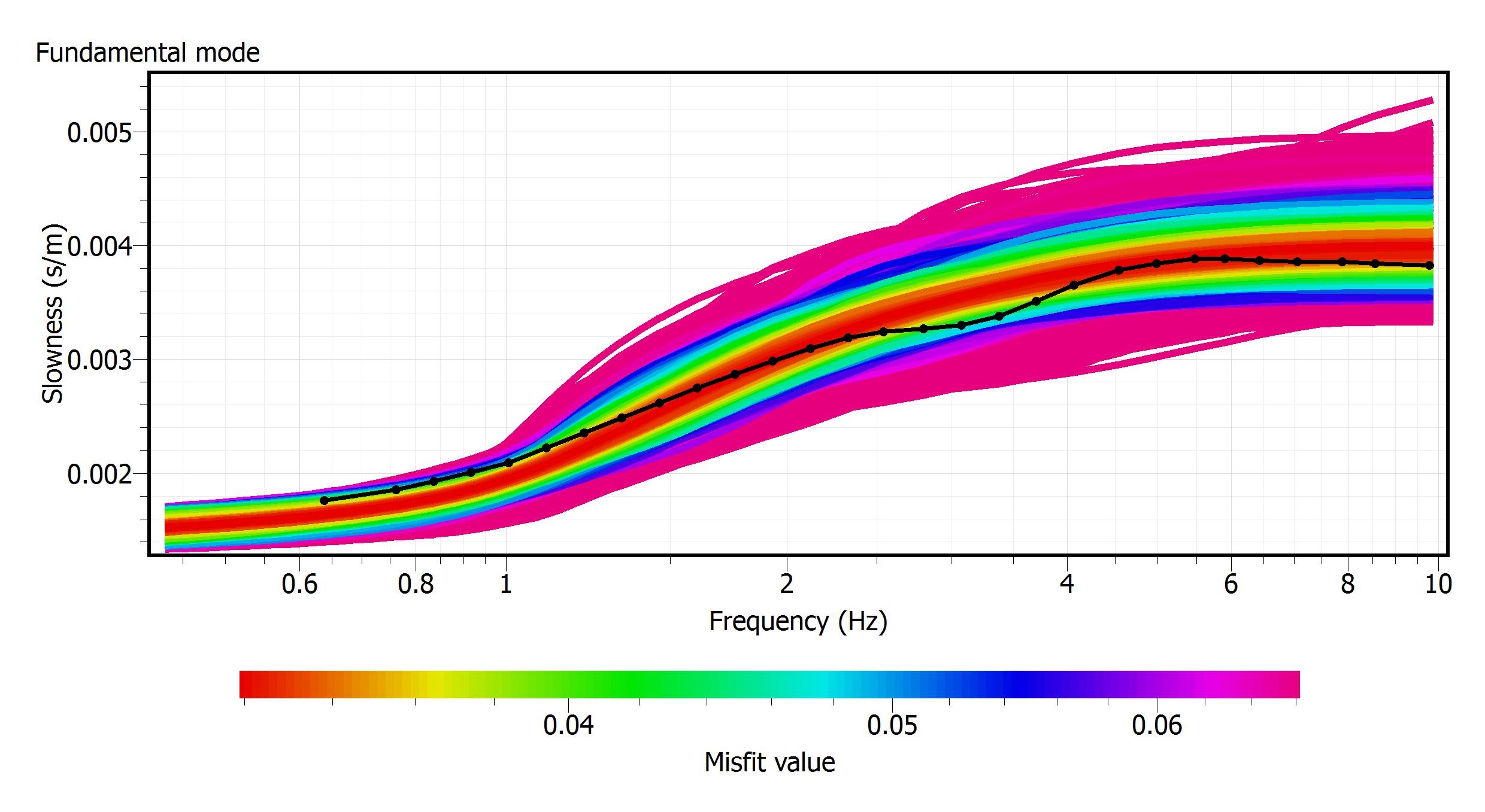
| dispersion curve | Image |
| Vs profile | Image |
| Vs30 [m/s] reference | 270.0 WG_INGV_DPC-B2_2017 |
| Vs,eq [m/s] reference | 270.0 none |
SEISMIC CODE | |
| soil category NTC08 | C |
| soil category NTC18 | C |
| topographic category | T1 |
© 2024 ISMD: INGV Strong Motion Data web portal |  CITATION | COOKIE & PRIVACY | DISCLAIMER | CREDITS | CONTACTS |